Walking and Sailing

Month: July 2024 (Page 3 of 3)

GR10 Day05

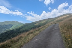
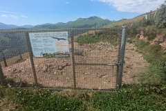
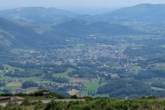
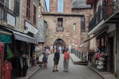
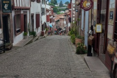
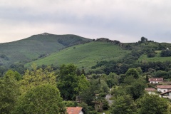
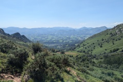
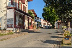
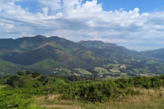
We left the hotel and walked back through the village.  The route took us uphill, first on a tarred road, but then on a track.  After about 500m of ascent we arrived at another road.  The option was now to follow the track round the east side, or the road on the west side, both climbing to the same col.  We walk faster on the better road surface, so we followed the road.  We got to the col, filled our water bottles at a tap, and set off upwards again, this time on a narrow path.  We reached the col, at just over 900m and stopped for a longer rest as it was very hot.  Again, we had a choice of continuing upwards, or walking on another road.  We took the road, thus avoiding an extra 100m of climbing.  We saw vultures circling above us again, as well as lots of buzzards and red kites.  As we descended the road we passed a feeding station for vultures; inside a large fenced area with dozens of carcasses, all picked completely clean.  We rejoined the GR10 and then had a very long descent in the heat down to the valley.  From there it was about another 6km to St-Jean-Pied-de-Port.  This is a nice old Basque town.  It’s one of the start points for the Camino de Santiago, so was thronged with pilgrims and tourists, which is always a bit of a shock, after several days of quiet.  The hotel owner offered to do our washing for us, so that was a big plus.  We had a good meal at a local restaurant and retired for an early night.  Tomorrow’s forecast is for rain, so we will probably be dodging showers.


Total distance: 19582 m
Max elevation: 924 m
Total climbing: 923 m
GR10 Day04

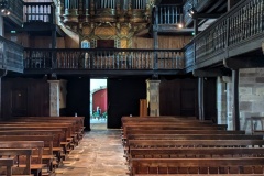
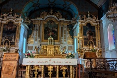
After three strenuous days, we decided that an easier day was in order, rather than the GR10’s 16km and 1300m up and down.  A look at the map showed that instead of doing the ridge walk, we could simply walk along the country lanes in the valley below.  This was a great choice and we walked at a good speed, meeting only a few cars and cyclists.  All the time we were looking at the ridge above us, wondering how everyone else was getting on.  After about 10km we reached the “main” road, pleased to find that it had a pavement.  Even when there was no pavement, there was mainly a space with a dotted line separating us from the few vehicles.  Another couple of kms took us to Donostei where we stopped for lunch.  We had bacon and cheese quiche, and then a white chocolate and raspberry brownie.  (pronounced broonie.  According to the owner, “brownie” is allowed by the French Scrabble Federation.)  Then it was a few hundred metres to Saint-Etienne-de-Baigorry, our stop for the night.  We had walked 13km and climbed 300m.  We filled in time by sitting in the park, visiting the church, and then the chocolate shop where we both had a large ice cream.  Overall, a very pleasant day on the GR10.


Total distance: 12995 m
Max elevation: 355 m
Total climbing: 391 m


GR10 Day03

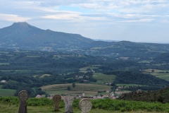
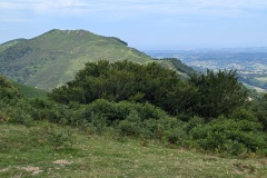
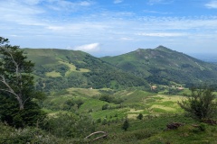
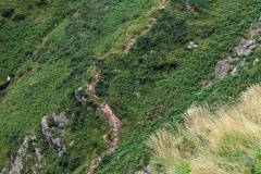
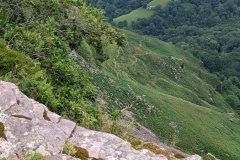
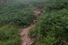
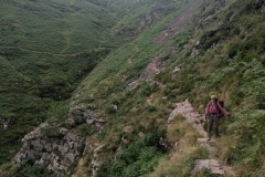
We were up early and had a very nice breakfast.  We left at 8:30 and immediately started climbing on a road that became a path, ending up at three crucifixes about 300m above the village.  We had a short stop here, and then continued upwards, traversing round the northeast side of a hill.  We reached a col, and crossed over to the southeast side of the next hill.  There was a long section along the hill before we gradually worked our way down to a farm.  The path led us to a large pile of manure, with deep mud on either side and pigs lying in it.  We found a route through by jumping over the mud onto the dry manure and following other footsteps over and onto dry ground on the other side!  This was followed by a section on road, including some very steep sections; so steep that a couple of cyclists had to push their bikes up the road.  The road was blocked by horses and hen a short while later by cows, but they didn’t seem too concerned as we made our way past.  At the col, there were several Neolithic grave sites.  There was then a lovely walk on grass, slowly descending, before we arrived at the cliffs at the top of “the worst descent on the GR10”.  We had another rest and then started down.  The first section down was very steep, with wires to hold onto at certain points.  As Christine said, if you are only 5ft 2in with short legs, some of the some of the drops between stones were a bit of a stretch, and necessitated a sit and slide technique.  We reached the bottom of that section, where the path then traversed across the slope, gradually losing elevation.  Some bits were OK, but there were many steep sections down rocks that required care.  You weren’t going to fall over the edge and die, but a fall could easily lead to a broken ankle or leg.  Egyptian vultures were living on the cliffs opposite and every so often there would be twenty or more in the air, both above and below us.  We finally reached the bottom and were back onto tarred road.  After a couple of kilometres there was another track leading uphill, before a final section of wide path and then road leading to the village and our accommodation.  We had a good meal in the restaurant, finishing before the TV was turned on for the Spain-France football match.


Total distance: 22844 m
Max elevation: 716 m
Total climbing: 1113 m


GR10 Day02

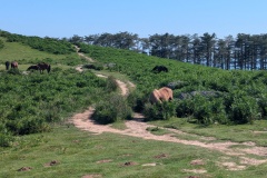
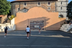
The breakfast was up to the standard of last night’s meal.  We left shortly after 9am and started the long climb.  There were plenty of people on the trail, many with no rucksacks, but quite a few who were obviously doing one of the Pyrenean routes.  We made it up to the col having climbed almost 500m and stopped for a drink and some food.  There were several horses begging for food; they all wear bells apart from the foals.  Having recovered from the climb we started on the descent, crossing over the cog railway that goes to the top of la Rhune.  The descent wasn’t too bad, though there were plenty of rocky areas requiring careful foot placement.  We finally got onto roads down in the valley.  Here we deviated from the route to avoid going into the village of Sare.  It was now getting extremely hot and we made slow progress in the afternoon because of the heat.  We climbed a cobbled track out of the village and then had a long section of tarred roads and graded tracks.  We had several breaks on this section and chatted to another couple of walkers, one of whom was planning to walk to Germany.  We walked an interesting section of road along the boundary between France and Spain; France to our left and Spain to our right.  We then dropped down to follow a section alongside a stream and it was back to crossing very muddy sections in places.  There was a final (never-ending) climb out of the stream before dropping down to the village of Ainhoa.  This really is a classic Basque village, very picturesque, and the pelota court in the village square in constant use while we sat at the bar and had a drink and our evening meal.

Total distance: 20873 m
Max elevation: 565 m
Total climbing: 934 m


GR10 Day01

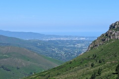
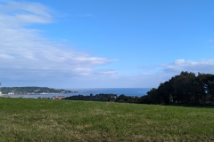
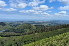
An early breakfast at 7:30 which was nothing special.  We packed and left about 8:40.  The route took us beside the sea, then started climbing through the old town (which looked fairly new).  We were soon into the country, crossing under the motorway linking France to Spain.  We followed an alternative route so rather than going up, along, and down a ridge, we contoured along on another path before rejoining the GR10.  We stopped here after about 3 hours of walking and were more than halfway to our destination.  There were lots of raptors overhead but we couldn’t decide whether they were buzzards or something larger.  There were great views looking north towards Biarritz and the long sweep of the Atlantic coastline.  We started descending and I said, looking at the map, “there’s a village ahead”.  Christine replied, “don’t get your hopes up, there will be a few houses and nothing else.”  As we entered the village, we were amazed by what we saw.  The road was in France, but on the Spanish side there were supermarkets, whisky shops, drinks outlets, cigarette shops, a giant petrol station, and a few clothes shops.  There were no houses, but a few Spanish restaurants and the French side of the road was lined with restaurants which seem to be built from wooden shacks.  There were various carparks, with about 1000 cars in total.  We saw numerous people with their supermarket trolleys full of alcohol.  We walked through “the village” and were back into France proper.  We had another steep climb, and then descended on a nice trail.  From here the trail got a lot worse and we were either picking our way round patches of mud, walking through mud, or walking carefully over large stones as we gradually descended.  There was another climb before our final descent, again very stony, down to the end of the stage and our accommodation for the night.  We were having a drink when a Danish couple arrived.  They said they had been on the trail for over 11 hours as they kept getting lost; we took about 7.5 hours including stops.  We had an excellent meal of pintxos, which are the Basque equivalent of tapas.  An early night and hopefully we can still walk tomorrow!


Total distance: 22507 m
Max elevation: 526 m
Total climbing: 1045 m
Newer posts »

© 2025 Travelling Slowly

Theme by Anders NorénUp ↑