Walking and Sailing

Month: August 2024 (Page 3 of 3)

GR10 Day28

Over the next couple of days we again have to walk on the GR10 variant as there is no staffed accommodation on the GR10.  The book recommended walking from the refuge to Eylie-d’en-Haut and then to Bonac.  Then the next day from Bonac to Esbintz.  The first day would take nearly nine hours and the problem was there was no accommodation available at Bonac because of a festival.  The village just to the west of Bonac had nothing either, but there was accommodation at the next village east.  Rather than doing nine hours we decided to follow the GR10 to Eylie-d’en-Haut, then walk along the road to our stop for the night, about 15kms along the road and much faster than following the “approved” route.  This was all planned, and accommodation booked, before we left England.  

In the refuge I was looking at my map and realised there was an alternative route down to the road which would save about an hour of walking so we took that path; it was a well-maintained path on a gentle descent.   On the way down, we saw two runners intently studying the opposite hillside and pointing.  We reached them and asked what they were looking at.  “A bear crossed that open bit of hillside and then went into the woods”.   We kept watching but the beat never reappeared.   We reached a village and stopped at the shop for a coffee and cake.  I now checked on the location of our accommodation for the night and realised I had booked somewhere far away from our planned destination, I think because it had the same area address.  Rapid searching on Google identified a suitable gite, which we were able to book, and there was another call to our original accommodation to apologise and say that we wouldn’t be turning up.  Our new accommodation was further on our route, but was still on a road.  Having sorted everything out we started walking again.  We kept on the quiet road rather than following the GR10 variant and had a pleasant walk as the road descended slowly downhill.  At the bottom of the valley we turned to head up the next valley and had about 5kms to walk to our beds for the night.  In total we walked 24kms, but averaged about 4kph, so a not bad day.  The gite is owned by a Dutchman who moved to the village, is a keen photographer and walker, and has a huge collection of books about the Pyrenees, including some of his own.  So everything finally worked out well, and our walk tomorrow is going to be relatively short.  (Time was also spent rechecking all our stops for the week ahead!)


Total distance: 24383 m
Max elevation: 1960 m
Total climbing: 331 m
GR10 Day27

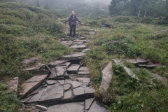
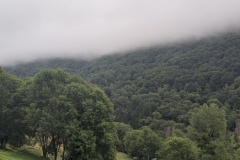
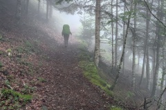
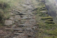
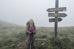
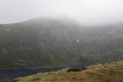
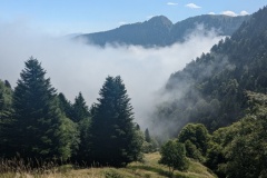
We had a good dinner in the gite.  Courgette tart, empanada, tortilla, salad, gazpacho, chicken nuggets and wings, hummus, and homemade savoury biscuits, followed by tiramisu.  We slept well and had an early breakfast before today’s big climb.  The cloud was over the valley and we assumed we would eventually climb out of it, but it was not to be.  The day’s walk started up a very quiet, dead end road for about 7kms.  We slowly climbed towards the cloud and when we reached it we put the covers on our rucksacks.  It was extremely humid and as we were already wet, we continued without putting our waterproofs on.  At the end of the road the path continued along an old track which was well built.  At the end of it the really steep ascent started.  We cleared the trees and worked our way up through a cliff section, finally clearing all the trees and getting onto moorland.  The visibility was poor and we could hear a shepherd shouting to his dogs.  Finally, we reached the col, and then had another 1km before reaching the second and final col.  There was still nothing to see because of the cloud.  We worked our way down the path towards the refuge, which we knew was about 45 minutes walk.  While I was checking the map to see how far we had to go, the cloud cleared slightly, and there it was about 100m from us.  We arrived at 2:30pm.  The Andorrans were there and told us they were planning on heading on to the next refuge.  They left and shortly afterwards the rain started pouring down.  A short while later the Andorrans returned having decided it was too wet to walk.  A German family whom we had passed early on arrived two hours after us, and said they had been up on the tops when the thunder and lightning started.  Not very pleasant for them!  The cloud rolled in and out all afternoon, plus thunder and lightning, while everyone sat inside reading and playing games.


Total distance: 18187 m
Max elevation: 2194 m
Total climbing: 1717 m

GR10 Day26

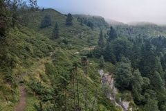
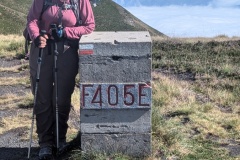
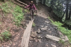
We set the alarm for 6am as today was going to be another long day.  The day was just brightening as we had our breakfast and then left the gite.  The first section was a series of huge zigzags up a farm track that crisscrossed the hillside, finally taking us high above Artigue.  We made good progress, passing a stone shepherd’s hut, and then onto a walking path.  The route took us upwards over several hill tops, each with a border stone at the top.  We had previously seen markers during our first few days and they were all cut from a single stone, with the details engraved.  These were much more utilitarian; made from concrete blocks and the number stencilled on them.  We then crossed a narrow ridge and started the descent.  This valley was full of cloud far below us.  We had been walking in sunshine and speculated on the conditions below:  colder, wetter?  We finally reached the tree line, and the cloud was about the same level.  A lot cooler, but no dampness.  We then had a big descent down through the trees on a good path.  Many of the zigs were 100m in length on a gentle gradient before there was a sharp turn and we were going in the opposite direction.  (This path has been put in as the previous route was deemed too dangerous for a descent). The guide book said 54 hairpins, but we didn’t bother counting.  At the bottom we had another 1.5km to walk to the village of Foss and our night’s accommodation.  A bit of a scare when we arrived and the owner said she wasn’t expecting us, despite the emails, but it was all sorted out.  A good meal (all home cooked) with the French speakers on one table, and the English, Dutch, and Andorran speakers on the other.


Total distance: 23195 m
Max elevation: 2188 m
Total climbing: 1293 m


Newer posts »