Walking and Sailing

Month: June 2025

Jura Day 23

Yesterday I said today was going to be leisurely; it was an easy walk, but it’s the wettest we’ve been in a long time.

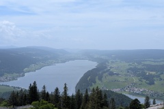
It was a nice path along the lake.  We looked up to see the hills completely covered in clouds and were glad of our decision to keep low today.  We were walking SW, and all the weather was coming from there.  We decided to cover our bags and put our rain jackets on.  This technique fooled the rain god, no rain arrived, and we took our jackets off about 30 minutes later as we were too hot.  We only met a couple of people on the path, but there were quite a few fishermen in boats or standing in the lake.  We saw a few heavy rainfalls in the hills around us, and spent a few minutes standing under a tree for one shower, but we were still dry.  We then put our jackets on just before the rain started; not too bad at this point.  We reached the village of Le Chenit, and passed through an industrial estate with the watchmakers Breguet, Romain Gauthier, and a short distance further on Blancpain.  We were now only 3km from Le Brassus and this is when the rain became torrential.  We nipped into a doorway for about 10 minutes and started walking again when it stopped.  Another kilometre, and the rain started again.  This time there was no shelter so we kept going.  We reached Le Brassus, passing Audemars Piguet, and went into the railway station to shelter from the even heavier rain.  It was now only 500m to the hotel, and as the rain decreased we made our final dash for the hotel.  200m to go, and the rain got so bad that we had to shelter again.  A brief respite and we made it to the hotel.  At least the receptionist wasn’t too bothered by our appearance!  We turned the radiators up to high and strung up our wet clothing to dry.  The rain seemed to be even worse as we looked out the bedroom window.  The good news is that the hotel restaurant is open tonight.

It is remarkable how many of the top watch manufacturers are located in a rural area; there are also many small manufacturers that we’ve passed that I’ve not heard of.


Total distance: 16534 m
Max elevation: 1043 m
Total climbing: 196 m

Jura Day 22

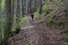
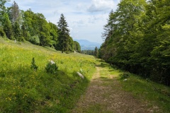
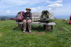
We left the hotel and walked to the edge of town.  The path started uphill almost immediately, and we followed a road for a while.  We took the old route up the hill, it’s probably been changed because of logging operations, but nothing was happening on a Sunday.  The weather was both hot and humid and it was hard going uphill.  The first road narrowed to a single path, which then turned into a 45 degree slope.  We struggled up to the top, and were finally clear of the forest on a good road.  We had climbed about 400m, but there was still more to go.  There was a walk through meadows and forest, before the track narrowed along a ridge and then started climbing again.  We worked our way up the final section and made it to the top, where there were crowds of people.  Looking over the western approach, we could see a car park and restaurant just a short distance below us; most had climbed for maybe ten minutes!

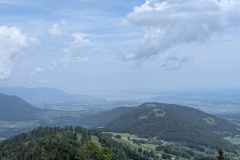
The view was not nearly as good as previous days.  We dropped down to the restaurant, and then had a reasonable descent to where the road crossed the col.  We then walked down on a good path to the village of Le Pont.  Again, we passed lots of fortifications and bunkers.  Perhaps the most impressive was yesterday where we saw a dry stone wall crossing the valley, except it was backed by 2m of concrete.

The stages of the Jura Crest generally finish on the crest, either at accommodation, or where there is a bus or rail link.  Tomorrow’s stage (Monday) finishes at a hotel which is shut on Mondays and Tuesdays, so we have booked a hotel in the same valley that we are in tonight.  I then discovered that the bus from the crest to the village 6only runs on weekends.  Tomorrow, therefore, we won’t be going up to the crest, but instead will have a leisurely walk along the lake to our next destination.  We are still deciding what to do on Tuesday when we do need to get back up to the trail.


Total distance: 13132 m
Max elevation: 1485 m
Total climbing: 807 m

© 2025 Travelling Slowly

Theme by Anders NorénUp ↑