Walking and Sailing

Author: alasdair.geo (Page 2 of 13)

GR10 Day42

A good dinner last night night, featuring a venison stew.  The deer had been shot by the gite owner with his bow and arrow.  Excellent bread at breakfast, with three different kinds, all made locally, and pots of homemade jams and marmalades.

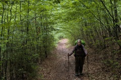
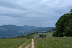
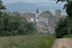
It was a quick climb on an old track, up through the terraces, to the col.  The whole hillside around the village was covered in terraced, all now abandoned.  On the other side we followed the old track down the hillside, occasionally walking bits of the new road, before more of the old track room is into the village of Py.  We had a cold drink at a small shop in the village.  We dropped down to the river and then started climbing again.  The scenery and vegetation now looked very Mediterranean, and even some villages in the distance had red tiled roofs, as opposed to the black slate that we have seen for so long.  We climbed up through the pine forest, past rocky outcrops, finally emerging at a busy carpark.  We stopped for our snack lunch and then started climbing again.  There was a fairly steep section, before we reached a “leat”.  This is a channel that takes the water from a stream along the hillside.  There was a good path alongside it, and we made rapid progress as there was only a slight incline.  We were amazed at the number of people that we met on the track coming towards us; all would be returning from their ascent of Pic Canigou.  We reached the refuge quickly and checked in.  During the evening meal the rain started very heavily and there was a dash by people to bring in the drying clothes.


Total distance: 17185 m
Max elevation: 1789 m
Total climbing: 1141 m


GR10 Day41

Today could be summarised as dry, drizzle, dry, drizzle, rain, dry, rain, dry, with lots of low cloud.

We crossed the stream and walked through the forest, which was a mixture of silver birch and pine.  All the beech trees have disappeared.  We walked through the middle of a herd of cows and one went down the track in front of us.  We looked round, and the entire herd seemed to be following us.  We crossed a small stream and were relieved to see the cows go off to investigate some campers and their tent.  Then the climbing started, up through the trees, on a mixture of straight up and zigzags.  We stopped to put our rain jackets on, cleared the trees, and walked up the grassy slope to the col in the rain.  There wasn’t much to see because of the cloud so we carried on.  The path led across the hillside and then started to descend.  We took this slowly, as by now all the stones and tree roots were very wet and slippy.  We got down the worst of the slope and then walked through a large old terraced area, on an old path.  We could see hundreds of terraces on the hillside across from us, around the village of Mantet.  There was no water covering the bridge (ford) in the valley bottom, so we walked straight across, and then up the track to Mantet.  We found the gite, and then went to a neighbouring restaurant for some late lunch.  The sun came out and we were able to put our clothes, socks, and boots out to dry.


Total distance: 12030 m
Max elevation: 2348 m
Total climbing: 701 m

GR10 Day40

Back to the usual routine of out the door and start climbing…

The initial path was on the road, but within a couple of hundred metres we were into the forest and climbing.  The path eventually levelled off, before heading about 2km along a narrow path on one side of the valley so that we could get to a crossing point and start back down the other side.  On the other side we were pleased to find that we were on a nice wide track and made good progress.  Of course, all good things come to an end, and we were soon on a very steep climb of about 800m to get to the col.  The path zigzagged up, then finally the gradient decreased.  We still had a few steep sections before the final walk of a few hundred metres up a grassy slope to reach the top.  There was no view behind us because of the thick cloud, but we could see the path down the other side.  We didn’t wait for the cloud to clear as it was chilly at the top, but quickly started the descent.  This was on an old rough road, going backwards and forwards across the hillside, but much preferable to the previous GR10 routing, which headed straight down the slope.  After several of these zigzags the refuge finally came into view.  A few more traverses and we were down at the refuge.  We were one of the first to check-in, so got our choice of beds in the dormitory – hopefully no snorers tonight! 

The refuge is the most basic that we have stayed in; no showers and the toilet is situated about 100m away.


Total distance: 17522 m
Max elevation: 2379 m
Total climbing: 1300 m

GR10 Day39

(We must be getting near the end as last night’s wine was from the Banyuls area)

The forecast for the day was not good, and we woke to heavy rain.  We delayed our start for it to stop and reckoned if we walked quickly we could get to the end of the stage before the forecasted afternoon rain.  The walk (for once) started out on a broad forest track, with only small changes in elevation.  It made a pleasant change from the usual “out the door and start climbing”.  The forest was  interspersed with more open bits of moorland.  After a while we were able to take our rain jackets off.  All of the area is used for cross country skiing and the trail was very well marked.  We gradually descended, passing the edge of an upmarket ski village, and then through the village of Bolquere.  From here we walked a short section of road, rather than the GR10, and passed the highest railway station in France.  As we got to the level crossing, the gates closed, and “the yellow train” came through.  It had half a dozen coaches, with one completely open carriage.  We were now in a very wide, shallow valley, stretching to the north east and south west.  We crossed the main road and followed a country lane to another village where we were able to buy some food for our lunch.  We then walked through some fields, the first time since the Basque country, and climbed out of the valley to Planes, where the refuge was.  We had timed it well, as the rain started again just after our arrival.  


Total distance: 18912 m
Max elevation: 2017 m
Total climbing: 350 m

GR10 Day38

Today was to be a longer walk, but with a lot less climbing.  The path initially led down from the refuge (after another poor breakfast) and then started to climb up a broad valley.  We caught up on a group of about eight people and managed to pass them on the flat.  This seemed to upset the leader of the group, who increased his pace to follow us.  We then reached the first climb, so it was non-stop to the top to avoid them catching us.  We made it to the top and kept going, and the big group stopped, so we quickly got away from them as we started the descent.  This took us into a broad valley, past a lake, and then we started climbing again.  There were a few places where the granite boulders were too big to step across and some scrambling was required.  We got over the top, luckily the strong wind was on our backs, and felt the odd spot of rain. We descended into a very broad valley, and the rain turned from a few spots to heavy.  We put our jackets on, stood behind a large boulder, and had a cookie each.  The rain wasn’t going to stop, so we set off again.  The rain decreased and we then had a shower every so often as we continued down the valley.  The scenery was very Scottish; a very broad valley, a few trees, and granite boulders.  It was at least an hour of walking before we finally reached the next valley, with a large hydro-electric lake in it.  I thought there would be a lovely flat road around the lake.  Unfortunately not, as we spent an hour working our way along the lake on a path through boulders and tree roots.  We finally reached the dam and marched across it as the rain returned.  The auberge was at the other side, and we were soon in our room and drying out.


Total distance: 17907 m
Max elevation: 2483 m
Total climbing: 956 m

GR10 Day37

We left at 9am after another poor breakfast.  The old path immediately started climbing and twenty minutes later we were as the hot pools.  The water temperature was about 30C, but strangely the spring that could be seen flowing into the pools was cold.  We walked on past, climbing alongside a stream and finally crossing it, where we stopped for a break.  The path now turned into a much narrower valley and the gradient increased.  We stopped at another lake for a rest, before starting on the climb up to the col.  The path was not too bad and avoided most of the boulder fields.  Cloud was forming, so we were not in direct sunlight for most of the climb.  The descent was on the usual poor path down to the valley.  We could now see thunder clouds forming, so kept up our speed.  The path flattened out in the valley floor and we could see the refuge, unfortunately higher up than we were.  It was only a short climb, and time for a beer, soft drink, and crepes.  The refuge was busy, mainly because people were worried about the weather.  Thirty minutes later the wind picked up and the rain started. The common room was packed; many were hoping to walk further and others were waiting for the rain to stop to pitch their tents. 

The water at the refuge is contaminated (we had been warned about this a few days before) and there were lots of warning signs in the refuge. We therefore did not even wash in the evening (or the next morning)


Total distance: 9983 m
Max elevation: 2321 m
Total climbing: 1313 m

GR10 Day36

Luckily, we were up early and filled our water bottles before the water ran out.  Today’s walk took us uphill away from the refuge, then across boulder fields as we worked our way round two massive corries.  Great scenery again of the massive granite mountains around us.  We had a fairly short climb to our highest point of the day, before another big descent started.  The first descent took us down into a valley, then along it, before another big descent to the next valley.  We stopped at a small lake, along with lots of day trippers, and I had a quick paddle.  Then it was off down again, finally walking down one of the old cart tracks built between granite boulders, with lots of terracing.  We were running out of cash, required at some of the refuges, so dashed to the station and caught a train (15 minutes late) to the town of Ax Les Thermes, which had several ATMs.  We stocked up on cash, and had time for a fizzy drink and cake, before going back to the station.  Thunder clouds were building as we waited, and when we got back to Merens-les-Vals the thunder and lightning were going off and we could see rain in the distance.  I suggested a taxi, but Christine insisted on walking and we reached the auberge twenty minutes later.  The rain never came as we sat and had a drink before dinner.


Total distance: 13744 m
Max elevation: 2505 m
Total climbing: 537 m
 

Total distance: 1017 m
Max elevation: 1147 m
Total climbing: 90 m

GR10 Day35

We helped ourselves to our allotted items from the cupboard for breakfast and set off just before 9am.  There was a broad track leaving the Nordic Village, meandering across the plateau and climbing slowly.  We then dropped down and had to work our way through a boulder field, before stopping at a hut where we refilled our bottles with very cold water.  We then started to climb up a broad, grassy slope.  We had made good progress to this point, but progress now became very slow as we worked our way along the ridge.  We were just below the crest of the ridge on a narrow track, with a very steep drop-off.  There were numerous areas where we had to scramble up or down a few metres.  We finally reached the end of this section and started the descent.  I was standing on the ridge, with a couple of higher points either side of me.  I was looking down the slope, when suddenly there was a great whooshing noise, and an eagle dived a couple of metres above my head.  It continued its dive down the slope, as I looked at it, thinking “what on earth was that?”.  As I watched, it pulled out of its dive and shot up into the sky far above us.  Christine was standing looking in amazement as this happened.  We then had a short climb and a very quick descent to the refuge.  There are crowds of people, including lots of children, and a few babies!  How they got here we don’t know, though definitely not our route.  We’ve got a room to ourselves and had a good evening meal.  No showers though, due to a water shortage.


Total distance: 14381 m
Max elevation: 2375 m
Total climbing: 1023 m

GR10 Day34

The earliest we could have breakfast was 7:30 as the owner had to get bread from the shop.  This was a bit of a problem as today was going to be the longest walk of the entire GR10.  We also ordered sandwiches, which came with ham, tomato, cheese, and hummus in French bread.  This was also a potential dinner for us in the evening to avoid having to cook. 

We climbed out of the village, passing through Gesties.  As we left Siguer, I mentioned that it wasn’t too hot, but we were both soaked in sweat by the first village.  The climb kept going up through the trees and we eventually reached moorland.  There was a long stretch before we started descending down through the bracken to the valley floor, where the path took us alongside the steam.  We crossed the valley and started climbing again. This path was quite good, being covered in beech leaves and nuts.  We speculated that the path down the other side would be equally good.  At the top we had another big descent.  Unfortunately our hopes were dashed as the route went down the slope between the trees and boulders.  There were lots of “paths” and we often had to stop and look down at the trees ahead to spot the next GR marker showing the way to go.  We finally reached the bottom and had a brief flat section before starting climb number three.  The path zigzagged up through the trees, finally getting above them onto a rocky ridge.  We stopped to fill up our water bottles at a spring, deliciously cold, and a few minutes later we were on the Plateau de Beille.  Another couple of kilometres on a rolling track for us to the ski centre and the “Village Nordique”, our home for the night.  We left at 8:10, and arrived just after 19:10, so eleven hours including stops.  We had a yurt for the night.  There was also a small shared cabin in which you could buy and cook food.  We finished our sandwiches and crashed out to the sound of an accordion and trumpet playing traditional French music.


Total distance: 23287 m
Max elevation: 1906 m
Total climbing: 2488 m


GR10 Day33

Today was a relatively short day.  This means you tend to get up late, start walking late, and the temperature has risen.  We had breakfast at 8am, and started up the path to the first village.  We were soon extremely hot and sweaty.  Luckily, we didn’t have much more climbing after that as the route took us along a shaded forest track, paralleling the contours.  We reached a closed refuge and sat in its veranda and had snacks for lunch.  The track continues to the col, and then we started dropping down, again on old farm tracks leading through old terraces.  We reached the first village and went down the old path to the next village.  Another path led on down through more terraces to the village of Siguer.  All these paths and terracing must have been a huge amount of work with no mechanical equipment.  The hotel in Siguer was a big surprise; two or three old buildings had been knocked together and renovated to create a quirky boutique hotel, which had featured in various magazines.  For once, our bedroom was not on the second floor, it was on the third!  The owner seized Christine’s bag to carry it up to our room, which featured a bath. 

We sat out on the terrace for a drink before a very good dinner. 


Total distance: 17605 m
Max elevation: 1551 m
Total climbing: 922 m


« Older posts Newer posts »