Walking and Sailing

Author: alasdair.geo (Page 8 of 13)

AA Day 22

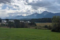
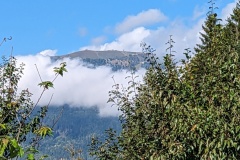
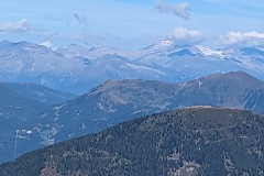
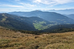
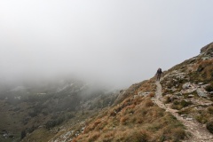
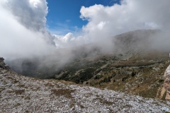
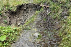
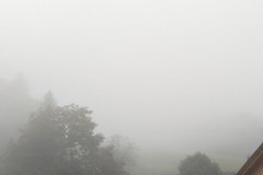
We woke to cloud obscuring the valley and the mountains above.  Breakfast was the usual assortment of cereals, cheese, cold meats, fruit, bread, etc.  A short while later the rain started falling heavily and we were glad that we had booked a taxi.  The taxi turned up on time, and after driving over the mountain pass we were in Kranjska Gora 45 minutes later.  The taxi driver told us about other people who had had problems on this Stage, and that it definitely wasn’t advisable in bad weather.

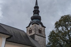
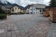
We left our bags at the hotel and went for a walk around town, including stopping for a coffee and cake.  It’s a big downhill, x-country and ski jumping centre, having held world championships and more to take place next year.  The town is quite small and quiet, with various places shut until the ski season starts.  We finally checked into the hotel and did some washing.  The forecast for the next several days is good and we are looking forward to tomorrow’s walk over the pass into the next valley.  (The original road was built by Russian forced labour during WWI, with many dying during the construction)


AA Day 21

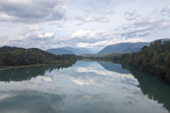
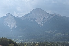
We had a rest day in Velden.  There was no launderette there, but there was one in Villach, a 15 minute train ride away.  We had a large breakfast and then walked to the station where we boarded a huge intercity train.  It had come from Venice and was going onwards to Munich and Stuttgart.  The launderette was a short walk from the station and we got everything washed and dried (and not shrunk).  Christine was able to rake up enough German to explain to an Austrian woman how to add credit to her laundry card, select the correct machine, and get the wash going.  We then walked into the old town area.  We had stayed here a few years ago on an earlier walk.  Villach is famous for having been destroyed by an earthquake in 1348, one of the largest ever experienced in Europe.  The mountain to the south lost about half its volume in a landslide.  The earthquake is well documented as the local bishop requested reports from all the churches and these have been used to map the effects.  We had coffee and cake and then went back to the station.  Trains were delayed, but we were just in time to catch a replacement bus service, which allowed us to see a bit more of the countryside. 

The forecast for the next few days is not good, the very exposed ridge walk for Stage 22 to Kranjska Gora has been in cloud every afternoon, and we have therefore decided not to walk over the mountains to Slovenia, but go by taxi instead.

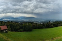
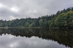
Today’s forecast was for the morning to be overcast and then heavy rain later.  We decided to take the train from Velden for a couple of stops to cut down on today’s walk and maybe beat the rain.  We had a short walk to the station, then rode two stops to Foderlach, where we had a short walk to join the trail.  The route took us around another small lake, and through forest and pasture.  The rain started and we covered our bags and put our jackets on.  The rain wasn’t too heavy, but it was sweaty wearing jackets.  As we started the final ascent the sun started coming out and we thought we were going to be lucky.  We arrived at Finkelstein castle and found a cafe, where we decided to stop for a drink.  As we sat down, the rain started to come down really hard, with big rolls of thunder and some lightning. 

We’ve enjoyed our apfelstrudel and are now wondering what to do.  It’s about 900m, or 15 minutes to our night’s accommodation.  We could go the direct route along the path, which by now will be very wet, or go the longer route by the tarred road which will be faster walking and better underfoot.  We’re hoping that there may be a break in the rain and we can make it without getting too wet.

We finally put our jackets and waterproof trousers on and started on the direct route.  The rain wasn’t too heavy, and the track was well kept.  There was a short final climb through the woods, then across a field to the hotel.

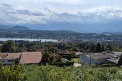
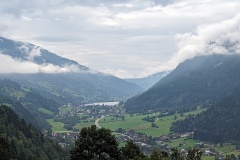
We have a great view from our room, and the sun came out as we unpacked, showing Villach, the lakes, and Gerlitzen. 

The rain is now pouring down again, there’s low cloud, and it’s good to be inside!


Leaflet | Data © OpenStreetMap contributors, Maps © OpenStreetMap contributors, CC-BY-SA, Imagery © Mapbox
Total distance: 539 m
Max elevation: 470 m
Total climbing: 20 m
Leaflet | Data © OpenStreetMap contributors, Maps © OpenStreetMap contributors, CC-BY-SA, Imagery © Mapbox
Total distance: 14007 m
Max elevation: 923 m
Total climbing: 616 m
 

AA Day 20

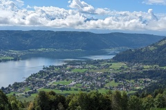
On leaving Ossiach we decided to walk up the forest road, rather than climbing the steps in the gorge.  We made the 400m climb in about 50 minutes and then stopped for a rest on a bench overlooking the small lake.  The track continued through the forest, which was a mixture of beech and conifers.  For once, this forest track was very easy walking, mainly on fallen leaves.  It does look as if autumn is arriving, with the bracken turning brown and leaves (and cones) falling.  We finally caught a glimpse across the lake to the top of Gerlitzen, where we had spent the previous night.  The track now swung to the south, and we were soon on tarmac, walking to the small village of Oberdorf.  The church had some Roman stones in its vestibule, and also three memorial plaques for men killed in the war; including one in Finland, and one in Murmansk.  (The German army escaped in 1944 with the bulk of their forces intact).  From here, we followed a country road rather than doing another walk through forest, but soon rejoined the Alpe-Adria trail.  This took us past another small lake.  Again, the area was full of very large holiday homes, many closed up for the season, or until the weekend?  There was another short section of road-walking before we reached a viewpoint overlooking Velden Am Worther See (Velden the town and Worther the lake).  It was a short walk from there into town and the end of the stage, and from there to our hotel.  This is the biggest place we’ve been in since the start of our trip, and has some expensive shops and hotels, lots of visitors, and a casino!

We’ve got a rest day tomorrow.  There’s no launderette, so we are planning a train excursion to Villach, about 20 minutes on the train, where we can use one.


Leaflet | Data © OpenStreetMap contributors, Maps © OpenStreetMap contributors, CC-BY-SA, Imagery © Mapbox
Total distance: 16064 m
Max elevation: 942 m
Total climbing: 584 m


AA Day 19

Despite all the bad reviews of the hotel and restaurant on Google maps, we had a really nice meal last night. 

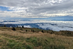
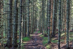
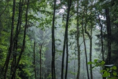
It rained heavily overnight.  That seems to have cleared the air, for the forecast for today was now dry, sunny weather.  In the morning, the valley below us was full of cloud.  We started on the trail down, initially on gravel paths alongside the ski runs, but then off into the forest.  This made for slow progress, as every tree root, and every stone, was very slippy.  We assumed we would have views of the lake, but all we could see were trees.  The path would be reasonably wide, but then there would then be a section where it narrowed and dropped down through the trees before paralleling the hillside again.  This repeated several times as we gradually descended.

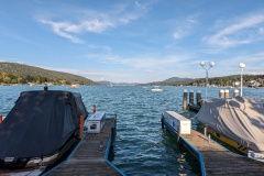
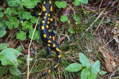
I spotted a fire salamander on the track, we then saw another four in about 400m.  They were all climbing uphill for some unknown reason.  Not only was the path slippy, but other parts were very boggy with standing water.  We dropped down into the cloud as it was beginning to burn off, and finally got our first view of the lake.  The low cloud was now gone and the day warmed up a lot.  We reached the lake at Steindorf and decided to wait for the ferry to Ossiach, rather than walking the final 5kms around the lake to the southern side.  We were looking forward to an ice-cream or cake, but Steindorf has nothing, all the shops are 5 minutes drive along the lake in the next, bigger, town.  We found a bench by the pier and removed our socks and boots to allow them to dry in the now very warm sunshine.  It’s a 2 hour wait for the ferry, so it’s nice and relaxing.  The ferry took 15 minutes and when we arrived in Ossiach we walked on to the stage end, about 400m.  There were two busloads of people walking towards us, all going to look at the abbey.  We checked into our hotel, and when we came back out it was a bit different – no people.  The supermarket opens from October to March, the pizzeria re-opens in May 2024, all the hotels, apart from our hotel and another, were closed.  The other hotel had a restaurant that was open, where we ate this evening.  It was busy, presumably because there is nowhere else to eat, though we were not sure where all the people had come from; the car parking was busy.


Leaflet | Data © OpenStreetMap contributors, Maps © OpenStreetMap contributors, CC-BY-SA, Imagery © Mapbox
Total distance: 13109 m
Max elevation: 1906 m
Total climbing: 78 m


AA Day 18

Today’s trail description includes the sentence “Whilst most active sports lovers take the cable car to reach the summit, the Alpe-Adria trail leads towards the summit along forest tracks…”

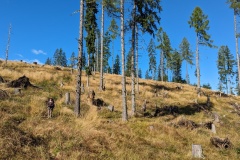
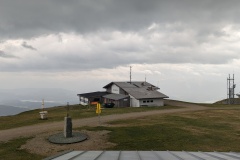
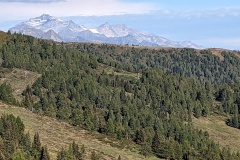
Surely active sports lovers would much prefer walking the 1197m vertical to the summit we said to ourselves this morning as we left the hotel, walking out of the village downhill on the road.  The downhill section didn’t last long before we started the long uphill section.  (There was some impressive damage repair taking place in the valley following the rain of two weeks ago.  Two bridges had been damaged and the banks of the river were being stabilised with boulders.)  We were initially walking on road before we changed onto a forest trail.  This road was in good condition, but a fairly shallow gradient, which meant long stretches between each of the zig-zags up the hill.  A gap in the trees allowed us to see the top of the Gerlitzen, the end of today’s stage.  We stopped for lunch (crisps and sultanas) just where the road ended.  The path then worked its way almost straight up through the pine and larch forest.  The trees were widely spaced, allowing grass to grow, and there were numerous large ant hills.  We had now reached 1655m and had a relatively flat section before suddenly reaching the end of a tarred road and seeing “several romantic Alpine lodges”.  We then met the Germans with their dog; they had taken a lift from the hotel all the way to the start of the forest section this morning!  From here we had the choice of going via a water park, or walking the road directly to the top.  The wind was increasing and the mountains to the south had disappeared in the storm clouds, so we decided to take the fastest route.  We still had 230m vertically to go, with the wind increasing all the time and the valley below us disappearing in the rain clouds.  We made it to the hotel and remarkably it still hasn’t rained.  The top, with several ski lifts dotted about, is a desolate place.  The wind has now dropped, as we no longer hear it in our bedroom.  The bedroom seems to have had a very recent facelift with a very fancy, large, bathroom, and the hairdryer definitely unused.

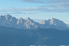
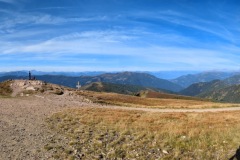
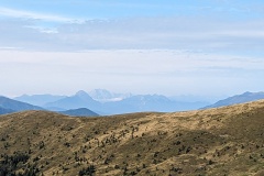
If it was clearer, we would be able to see the Slovenian mountains to the south.  We will have another rest day in two days, so will be into Slovenia in six days.  Na zdravje!


Leaflet | Data © OpenStreetMap contributors, Maps © OpenStreetMap contributors, CC-BY-SA, Imagery © Mapbox
Total distance: 14890 m
Max elevation: 1910 m
Total climbing: 1246 m


AA Day 17

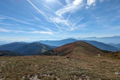
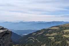
We stayed at the Explorer Hotel in Bad Kleinkirchheim.  This is number nine in a chain of ten, opening a new one every year in Austria or Germany.  Facilities included cubicles for bikes or skis in the reception area, a bike repair station, and bike washing facilities.  They were also advertising fell-running and cross-country ski courses.  Not many people in the bar yesterday evening, but plenty at breakfast, where you could cook your own eggs as you wanted them.  We were presented with a card each which allowed (amongst other things) free access to the Kaiserburg cable car.  We decided to use this, as the cable car took us to near the top of the mountain, saving us at least three hours of climbing up 1000m on the Alpe-Adria trail.  We had a 25minute walk to the cable car along a path next to a stream, and then were whisked to the top.  From there, it was a short uphill walk to the summit of the Wollaner Nock at 2145m, which provided 360 degree views of the surrounding mountain ranges.  We headed south, dropping off the summit before climbing to the summit of Vorderer Wollaner Nock at 2090m.  From here we could see Arriach far below us in the valley, our destination for the day.  We had left most of the people on the first summit, and from here we hardly saw another person.  The path dropped quickly off the summit before joining a forest track.  This slowly worked its way down the hillside.  We stopped and had our photo taken by a webcam at the “geographical centre” of Carinthia, before finally getting onto tarred road.  The road quickly took us to Arriach.  We did some washing and then had a nice dinner, finishing off with a visit to the hotel’s wine cellar.


Leaflet | Data © OpenStreetMap contributors, Maps © OpenStreetMap contributors, CC-BY-SA, Imagery © Mapbox
Total distance: 1968 m
Max elevation: 1069 m
Total climbing: 63 m


Leaflet | Data © OpenStreetMap contributors, Maps © OpenStreetMap contributors, CC-BY-SA, Imagery © Mapbox
Total distance: 13245 m
Max elevation: 2143 m
Total climbing: 191 m


AA Day 16

After yesterday we decided not to do another day of 20kms and1000m up and 1000m down, but instead walk down the valley to Bad Kleinkirchheim, the end of the stage.  This took us less than 2 hours.  We found a cake shop and enjoyed cake and coffee.  A nice relaxing day.  (The map shows all the peaks to the east that we didn’t climb today)


Leaflet | Data © OpenStreetMap contributors, Maps © OpenStreetMap contributors, CC-BY-SA, Imagery © Mapbox
Total distance: 8023 m
Max elevation: 1647 m
Total climbing: 19 m


AA Day 15

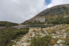
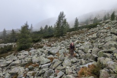
The day started with a 1.5km uphill walk to the start of the stage.  We made good progress on forest tracks before crossing some moorland.  There were big cliffs to our right and we knew that we would eventually be on top of them.  The trail led steeply upwards through an area of woodland, finally finishing at a lake, where we stopped for a rest.  The next section led through a massive boulder field, which we crossed by stepping from boulder to boulder, continually watching out for the trail markers ahead.  This was slow progress, with our speed down to less than 2kph.  Low cloud was blowing over us all this time, with glimpses of sunshine.  We then walked on one of those narrow paths with nothing to stop you if you should put a foot wrong.  This included some sections where the step up or down the path was a metre high, requiring even more care.  The path took us to the top of the cliffs and we were now in an area of rolling moorland.  We reached the summit of the first hill, then followed the cairns up to the second peak.  The mist was still rolling about, giving impressive views.  The path finally dropped down the side of the mountain in a long series of zig-zags, before climbing up to the next peak.  The path led round the peak rather than going to the top, and if I thought the last path was exposed, this was a lot worse; a steep slope below you for maybe 50m, and then you couldn’t see any more of the slope before it disappeared into the valley far below.  We were now only about halfway through the walk and had another steep descent, before yet another climb.  We stopped at the top of it and could see our entire route up to that point.  We had walked NW, NE, E, and S, and were now not very far from where we had started the day, but considerably higher.  The path finally dropped through the woods to the end of the stage.  (We missed one sign and ended up on the wrong track.  Luckily it was far before we realised our mistake.)  We then had another 100m of climbing to get to the hutte, where we were warmly welcomed by the owner.  In comparison to last night, this had been entirely renovated, with a lovely warm shower room.


Leaflet | Data © OpenStreetMap contributors, Maps © OpenStreetMap contributors, CC-BY-SA, Imagery © Mapbox
Total distance: 17933 m
Max elevation: 2193 m
Total climbing: 1259 m


AA Day 14

We left Dollach and walked up the valley on an easy path alongside the river, only going up 120m in 5.5km.  We then climbed about 300m in 1.5km on a forest path, which was extremely steep in places.  We then got onto a road, before this turned into a forest road, which sloped upwards through the valley, but on a much better gradient.  It was about 6.5km to our accommodation.  We hadn’t managed to get booked in the hutte at the end of the stage as it was full; our hutte was about 1.5km before the end.  This was the most “rustic” place that we’ve stayed.  We were the only people staying, and had our own bedroom (no heating).  We joined the owner in the kitchen to chat as it was nice and warm.  We had made fast progress getting to the hutte as the weather forecast was not good.  About an hour after we arrived the rain came hammering down and we were very pleased to be indoors.  A German couple arrived, having driven up the track (very slowly) in their Porsche 911.  They stayed for dinner and then left, and we continued chatting to the owner.  Later a neighbour arrived.  He looked after 130 cows spread around the hillside.  They are now beginning to move them down for the winter using a trailer rather than walking them down.  We had an early night as tomorrow is one of the harder days on the Alpe-Adria.


Leaflet | Data © OpenStreetMap contributors, Maps © OpenStreetMap contributors, CC-BY-SA, Imagery © Mapbox
Total distance: 14817 m
Max elevation: 1459 m
Total climbing: 958 m


AA Day 13

The forecast wasn’t very promising for today; rain in the afternoon, so we decided on an early start to try and get over the tops before the rain.  The hutte is a working farm and breakfast featured all their own produce.  There were all sorts of cold hams, cheeses, butter, yoghurt, milk, jams, sour dough bread, and pancakes.  We left the hutte at 8:30 and made rapid progress in the gentle uphill trail past the next hut.  The trail started steepening, but it was fairly quick to the mountain top.  Again, there were fantastic 360 degree views.  We walked along the ridge to the next high point, where there were three people sitting.  The route started to descend and we suddenly started meeting people.  We must have passed 100 people on this section of the trail, many struggling upwards very slowly and unprepared for the forecast conditions.  We reached the car park where everyone had started from and enjoyed apple strudel, coffee, and a soft drink in the hutte.  We continued on the Alpe-Adria trail, and from here did not meet another person for the rest of the day, but there were plenty of cows.  It was a huge descent, over 1500m, with the first section along gently sloping forest tracks, which meant walking a long way.  We were about three quarters of the way down the descent when the drizzle started.  We carried on for a while, then stopped to put the covers on our rucksacks.  It was very humid with not too much rain, but about 20 minutes later we decided that rain jackets were the sensible option.  The trail finally steepened as we approached Matzelsdorf.  The final section along the lake led us round various private areas next to the lake.  We walked to the Alpe-Adria marker at the end of the trail, then continued on the next leg to our hotel in Dollach, a further 2km.  The holiday area at the lakeside seemed to be mainly holiday chalets (with one “romantic spa” hotel), but was deserted compared to Seeboden at the other end of the lake.  Our hotel in Dollach is in a building over 100 years old, but is very modern inside.  As I write, we are enjoying our first cocktails of the trip! 

The weather over the next few days looks a bit mixed.  We have a short day tomorrow, then a couple of mountain stages.  If necessary, we can take lower level routes rather than the main trail.


Leaflet | Data © OpenStreetMap contributors, Maps © OpenStreetMap contributors, CC-BY-SA, Imagery © Mapbox
Total distance: 25525 m
Max elevation: 2091 m
Total climbing: 555 m


« Older posts Newer posts »

© 2025 Travelling Slowly

Theme by Anders NorénUp ↑