Walking and Sailing

Author: alasdair.geo (Page 9 of 13)

AA Day 09

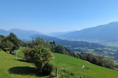
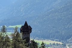
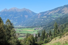
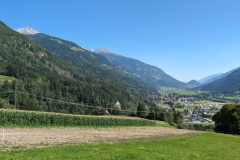
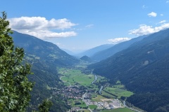
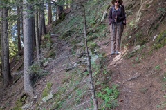
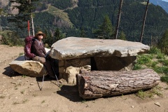
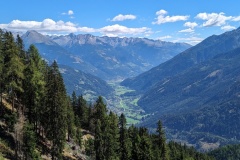
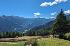
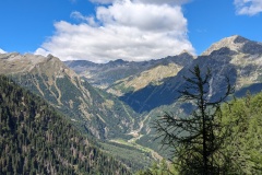
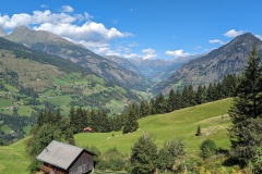
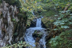
We had a good breakfast and set off on the track alongside the river.  Nice and flat, and we made fast progress to the next village.  We walked through the village and then entered the gorge (no fee today), supposedly following the route that Barbarossa took with his troops on return from one of the Crusades.  Quite why he would want to lead his troops up a narrow gorge, going nowhere, wasn’t obvious.  However, according to the story described on various plaques on the way up they saw a beautiful woman bathing in the water, then one of his troops drank some water which didn’t quench his thirst.  After this a hermit appeared, men drank more of the water and turned into stone.  Barbarossa’s companions fell asleep and he fought and vanquished the devil.  We then reached the top of the gorge, having survived any possible evil spirits.  The forest road tracked along the hillside, then turned into a tarred road so we again made good speed.  We passed an enclosure with three ostriches, and lots of other farms along the hillside.  We finally left the tarred road and followed a narrow path up to a restaurant where we enjoyed a cold drink.  The tarred road then gradually lost height as it went along the hillside, leaving us with a final climb in the heat up to our night’s accommodation.  As we neared the guest house the Germans’ luggage taxi passed us, also carrying them!  We had a drink on the veranda and the other two Germans also arrived.  They couldn’t understand how we had reached the finish before them as they had left before us this morning!


Total distance: 17515 m
Max elevation: 1049 m
Total climbing: 743 m
 

AA Day 08

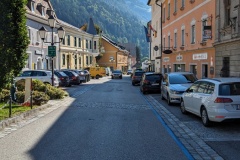
We walked out of Obervellach down the pretty main street.  The town had been the centre of the gold mining industry and there are many large 18th century buildings.  The path led up the hillside on tarred roads and we decided to keep on the road, rather than following the track heading higher up the hillside.  We passed a vineyard and were shocked to see the state of the vines; very small grapes and the leaves turning brown.  There will be no harvest there this year.  We continued upwards to a point where the Alpe Adria trail came back down the hillside, and we followed it downwards on a decent track.  We were soon back onto tarred roads, with the Danielsberg in front of us.  The harder rock survived the glaciers and remains as an impressive hill in the valley floor.  The path wound through forest to the top, then there was a quick descent to the village of Kolbnitz and our accommodation. The sign on the door said “closed on Thursdays” which was not good.  We phoned the owner and convinced him that we had a booking; after a discussion he said we could stay.  The guest house runs a small pizzeria, and the sign outside the front door changed to “open at 5:30”.  When we came downstairs this evening there was no sign of the owner or any staff, but the pizza oven was heating up so we took that as a good sign.  There were also other would-be customers sitting outside in the garden and regularly trying the locked front door.  Eventually the owner appeared with a large amount of shopping.  It’s now 7:15 and the first pizza had just been made!  Our pizza is in the oven as I type.


Total distance: 14418 m
Max elevation: 961 m
Total climbing: 655 m


AA Day 07

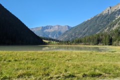
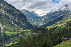
Today’s route started with a return walk up the valley to the Stappitzer See lake, so we left our rucksacks at the hotel and enjoyed walking with no weight on our backs.  The lake and surrounding mountains looked great in the early morning light.  We saw the German couple with Lou the dog, who are walking the whole way like us (though they get their luggage transported and didn’t walk yesterday’s stage) and the Dutch couple who are walking for about eight days.  We walked back to Mallnitz with the Dutch, then went to the supermarket, retrieved our rucksacks from the hotel, and then had an excellent coffee and apfelstrudel before starting on the next part of the day’s stage.  We left Mallnitz and headed down the valley.  The walk through the gorge was closed due to damage to the path caused by last week’s storms, so had to follow a diversion.  This took us through woods, and as we worked our way down the valley, we tried to spot yesterday’s route on the opposite hillside high above us.  We reached another section of gorge where a sign told us we could walk through the gorge for nine euros each, or follow the road instead.  We took the road and were soon on the outskirts of Obervellach, reaching the end of the stage within the proscribed time, despite having had over two hours of breaks.  We cleaned up and enjoyed a drink on the bar terrace opposite the hotel in the warm sunshine; there’s another four or five days of cloudless sky forecast.

After one week, we’ve walked 125kms, climbed 4424m, and descended 6066m.  

Total distance: 19425 m
Max elevation: 1310 m
Total climbing: 374 m


AA Day 06

We walked down the quiet road from Innerfragant, and where the Alpe-Adria trail turned off to follow the river gorge, we stayed on the road.  This meant we could walk at a good pace, and we then went onto a minor road to start heading up the mountainside.  About 2 hours later the Alpe-Adria trail rejoined the road that we were on, so we had saved some distance and height, but had managed to walk a lot faster on the tarmac.  The road continued upwards in a series of big hairpins before becoming a graded surface.  The hairpins continued until we finally reached over 1500m.  the trail started to descend, past one mountain hut, before finally dropping altitude to a large hotel, unfortunately shut on Mondays.  We sat under a tree and had our lunch of dried fruit, nuts, and chocolate.  The trail then turned into another path through the woods.  These tend to be narrow, with plenty of tree roots and boulders, and on significant slopes.  If you fall, you’re probably not going to go hundreds of metres down as you will (hopefully) be stopped by a tree, but these paths are definitely not for the faint-hearted.  The path finally dropped down to close to the road to Mallnitz.  We then had a final climb into the valley and a walk through fields, along the river, and into the town.  The town is the busiest place we’ve seen, with lots of day-walkers, climbers, and cyclists.  We had a good meal and are now looking forward to the next two “easy” stages after the last two days of significant climbing.


Total distance: 23428 m
Max elevation: 1557 m
Total climbing: 1133 m
 

AA Day 05

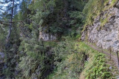
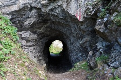
Today was an early start for one of the tougher sections of the Alpe-Adria.  We left Stall on a grassy path, and walked straight across the road onto the next path.  This was a big mistake.  We reached a fence after about 150m and were just debating what to do when the farmer arrived.  He dismantled the fence and we asked him how to get to the road, which we could see above us.  “Go that way”, he said, so we climbed up to the road on our hands and knees.  (We should have followed the road at the crossing point, but there was no sign).  Now that we were on the road we made good progress with our vertical climb, following numerous hairpin bends.  We eventually reached the point where we left the road and went onto a path, still making good progress.  This slowed considerably as we reached a section which traversed the mountainside, having to make our way over stones, rocks, and fallen trees.  We saw the Goldberghutte in the distance and eventually reached it, having finished the traverse.  We sat here for about an hour, admiring the spectacular views across the valley and into the distance.  The path on leaving the hutte involved a steep climb, but we then got onto a forest track.  After a short distance, we joined the Rollbahnweg, which had been built to provide access to the high pasture from the valley.  This narrow path kept an almost continuous elevation around the cliffs, including passing through a tunnel.  We reached the end of it and joined another forest road.  The final part of the day was the worst; 600m of descent in about 3km.  We finally reached Innerfragant and found our hotel, one of only a handful of buildings in the hamlet.  We celebrated with a soft drink and a large piece of chocolate cake and cream.


Total distance: 21927 m
Max elevation: 1828 m
Total climbing: 1279 m


AA Day 04

Today was almost entirely downhill and was a short stage.  The trail crossed a mixture of pasture and forest, walking on good tracks before we got onto wider forest roads.  We made fast progress, passing the three couples who had set off before us.  We took quite a few breaks as we knew we would arrive very early in Stall.  The tracks finally joined a tarred road, which we walked on almost to the outskirts of Stall.  The route then took us away from the main road before a final uphill section to the finish point.  We had passed the closed supermarket, and the hotel opposite also seemed to be shut.  The Dutch couple turned up, and I went down to a restaurant on the min road to see if it was open.  Good news, it was, and I went back and collected the others.  We had a good lunch, during which there was a bizarre incident.  A couple of motorcyclists turned up and one had a t-shirt with the Kuwaiti flag on it.  We spoke to them, and as they worked for the KOC, they knew people there from my time there; it’s a small world.  We walked back up to our accommodation, and will return for an evening meal in the same restaurant.

Nice scenery, but similar to yesterday, so no photos today.


Total distance: 12960 m
Max elevation: 1846 m
Total climbing: 138 m


AA Day 03

The route started with approximately a 6km walk alongside the river on a cycle track.  We made rapid progress to the village of Mortschach where the climbing started.  The track was initially along forest roads and there were impressive views in both directions along the valley.  We then started on a section of path that led straight up the slope through the trees.  This was hard work, and it took us 30 minutes to go one kilometre, but with a significant gain in height.  The track finally turned to go along the hillside, climbing gradually, including some staircases built along the cliff.  We finally reached the top, and walked a couple of kilometres to reach our night’s accommodation.  We sat in the sunshine and asked if there was any cake, but the reply was no.  The girl then asked us if we were on half board (we were) and asked us what we wanted, either schnitzel or sausage.  We replied, assuming we were pre-ordering our evening meal, the time was about 4pm.  About 5 minute later soup arrived, closely followed by our main courses.  A German couple explained that the kitchen closed at 6pm, and that this was our evening meal.  We enjoyed the food in the sunshine, then went in to explore our accommodation.  We had a bedroom to ourselves, but it seemed that everyone shared the bathroom and toilets.  The duvets were extra thick, there were spare blankets, and there was a large supply of hot water bottles in the bathroom.  We went back outside and chatted to other people who were walking, finally retreating inside as the sun set.  We didn’t need the hot water bottles, and had a reasonable breakfast before setting off the following morning.


Total distance: 19463 m
Max elevation: 1891 m
Total climbing: 1118 m


AA Day 02

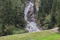
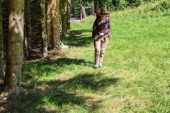
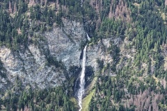
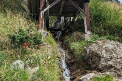
Today’s walk took us through woods and pasture a few hundred metres above the valley floor.  Many of the houses seem to be second homes or holiday lets.  The route generally headed east, but we had one gorge to cross.  The map implied there were two routes; a shorter one at the beginning of the valley or another route that went up the western side to the head of the valley then back down the eastern side.  At the junction there was a sign showing “no parents with children” on the shorter route.  As we didn’t have any with us, we decided to take the shorter route.  The path, looking a bit overgrown, led quickly down to a bridge, then up the other side of the gorge.  On this side there were several fallen trees to climb over.  We then reached a fence, which again we climbed over.  This had “do not enter” for those coming in the opposite direction.  We assumed we would now have a clear path to get to the main path, but there was another barrier, with large amounts of dead wood placed on it (see photo).  We negotiated this, then finally had to climb a 2m set of horizontal wooden posts to rejoin the main trail.  Christine admitted to enjoying our obstacle course.  We had great views back up the valley to where we had started, and a spectacular waterfall on the other side.  A small stream had several water-powered sawmills on it.  The trail then gradually started down to Dollach, crossing small roads several times, as we walked across pasture and through woodland.  There were a few sheep, goats, and cows, in the fields.  Our hotel was at the end of the stage and we checked in, noticing some walkers had had their luggage delivered.  This was classed as an easy stage, and even with a couple of breaks, we managed it in an hour less than the guidebook.


Total distance: 12255 m
Max elevation: 1555 m
Total climbing: 493 m


« Older posts Newer posts »

© 2024 Travelling Slowly

Theme by Anders NorénUp ↑