Walking and Sailing

Category: Alpe-Adria (Page 4 of 4)

AA Day 06

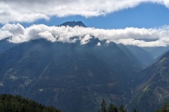
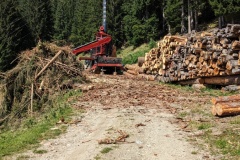
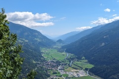
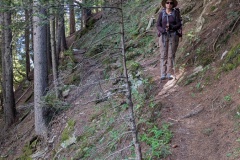
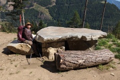
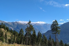
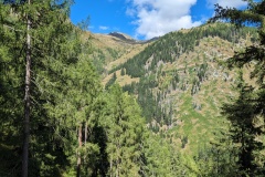
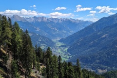
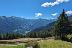
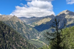
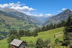
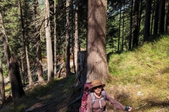
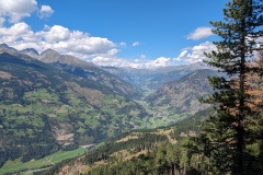
We walked down the quiet road from Innerfragant, and where the Alpe-Adria trail turned off to follow the river gorge, we stayed on the road.  This meant we could walk at a good pace, and we then went onto a minor road to start heading up the mountainside.  About 2 hours later the Alpe-Adria trail rejoined the road that we were on, so we had saved some distance and height, but had managed to walk a lot faster on the tarmac.  The road continued upwards in a series of big hairpins before becoming a graded surface.  The hairpins continued until we finally reached over 1500m.  the trail started to descend, past one mountain hut, before finally dropping altitude to a large hotel, unfortunately shut on Mondays.  We sat under a tree and had our lunch of dried fruit, nuts, and chocolate.  The trail then turned into another path through the woods.  These tend to be narrow, with plenty of tree roots and boulders, and on significant slopes.  If you fall, you’re probably not going to go hundreds of metres down as you will (hopefully) be stopped by a tree, but these paths are definitely not for the faint-hearted.  The path finally dropped down to close to the road to Mallnitz.  We then had a final climb into the valley and a walk through fields, along the river, and into the town.  The town is the busiest place we’ve seen, with lots of day-walkers, climbers, and cyclists.  We had a good meal and are now looking forward to the next two “easy” stages after the last two days of significant climbing.


Total distance: 23428 m
Max elevation: 1557 m
Total climbing: 1133 m
 

AA Day 05

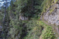
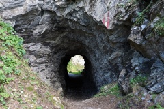
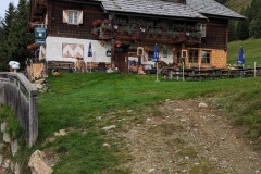
Today was an early start for one of the tougher sections of the Alpe-Adria.  We left Stall on a grassy path, and walked straight across the road onto the next path.  This was a big mistake.  We reached a fence after about 150m and were just debating what to do when the farmer arrived.  He dismantled the fence and we asked him how to get to the road, which we could see above us.  “Go that way”, he said, so we climbed up to the road on our hands and knees.  (We should have followed the road at the crossing point, but there was no sign).  Now that we were on the road we made good progress with our vertical climb, following numerous hairpin bends.  We eventually reached the point where we left the road and went onto a path, still making good progress.  This slowed considerably as we reached a section which traversed the mountainside, having to make our way over stones, rocks, and fallen trees.  We saw the Goldberghutte in the distance and eventually reached it, having finished the traverse.  We sat here for about an hour, admiring the spectacular views across the valley and into the distance.  The path on leaving the hutte involved a steep climb, but we then got onto a forest track.  After a short distance, we joined the Rollbahnweg, which had been built to provide access to the high pasture from the valley.  This narrow path kept an almost continuous elevation around the cliffs, including passing through a tunnel.  We reached the end of it and joined another forest road.  The final part of the day was the worst; 600m of descent in about 3km.  We finally reached Innerfragant and found our hotel, one of only a handful of buildings in the hamlet.  We celebrated with a soft drink and a large piece of chocolate cake and cream.


Total distance: 21927 m
Max elevation: 1828 m
Total climbing: 1279 m


AA Day 04

Today was almost entirely downhill and was a short stage.  The trail crossed a mixture of pasture and forest, walking on good tracks before we got onto wider forest roads.  We made fast progress, passing the three couples who had set off before us.  We took quite a few breaks as we knew we would arrive very early in Stall.  The tracks finally joined a tarred road, which we walked on almost to the outskirts of Stall.  The route then took us away from the main road before a final uphill section to the finish point.  We had passed the closed supermarket, and the hotel opposite also seemed to be shut.  The Dutch couple turned up, and I went down to a restaurant on the min road to see if it was open.  Good news, it was, and I went back and collected the others.  We had a good lunch, during which there was a bizarre incident.  A couple of motorcyclists turned up and one had a t-shirt with the Kuwaiti flag on it.  We spoke to them, and as they worked for the KOC, they knew people there from my time there; it’s a small world.  We walked back up to our accommodation, and will return for an evening meal in the same restaurant.

Nice scenery, but similar to yesterday, so no photos today.


Total distance: 12960 m
Max elevation: 1846 m
Total climbing: 138 m


AA Day 03

The route started with approximately a 6km walk alongside the river on a cycle track.  We made rapid progress to the village of Mortschach where the climbing started.  The track was initially along forest roads and there were impressive views in both directions along the valley.  We then started on a section of path that led straight up the slope through the trees.  This was hard work, and it took us 30 minutes to go one kilometre, but with a significant gain in height.  The track finally turned to go along the hillside, climbing gradually, including some staircases built along the cliff.  We finally reached the top, and walked a couple of kilometres to reach our night’s accommodation.  We sat in the sunshine and asked if there was any cake, but the reply was no.  The girl then asked us if we were on half board (we were) and asked us what we wanted, either schnitzel or sausage.  We replied, assuming we were pre-ordering our evening meal, the time was about 4pm.  About 5 minute later soup arrived, closely followed by our main courses.  A German couple explained that the kitchen closed at 6pm, and that this was our evening meal.  We enjoyed the food in the sunshine, then went in to explore our accommodation.  We had a bedroom to ourselves, but it seemed that everyone shared the bathroom and toilets.  The duvets were extra thick, there were spare blankets, and there was a large supply of hot water bottles in the bathroom.  We went back outside and chatted to other people who were walking, finally retreating inside as the sun set.  We didn’t need the hot water bottles, and had a reasonable breakfast before setting off the following morning.


Total distance: 19463 m
Max elevation: 1891 m
Total climbing: 1118 m


AA Day 02

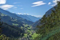
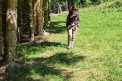
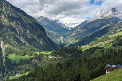
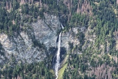
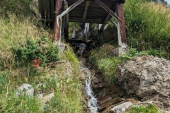
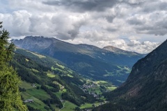
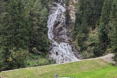
Today’s walk took us through woods and pasture a few hundred metres above the valley floor.  Many of the houses seem to be second homes or holiday lets.  The route generally headed east, but we had one gorge to cross.  The map implied there were two routes; a shorter one at the beginning of the valley or another route that went up the western side to the head of the valley then back down the eastern side.  At the junction there was a sign showing “no parents with children” on the shorter route.  As we didn’t have any with us, we decided to take the shorter route.  The path, looking a bit overgrown, led quickly down to a bridge, then up the other side of the gorge.  On this side there were several fallen trees to climb over.  We then reached a fence, which again we climbed over.  This had “do not enter” for those coming in the opposite direction.  We assumed we would now have a clear path to get to the main path, but there was another barrier, with large amounts of dead wood placed on it (see photo).  We negotiated this, then finally had to climb a 2m set of horizontal wooden posts to rejoin the main trail.  Christine admitted to enjoying our obstacle course.  We had great views back up the valley to where we had started, and a spectacular waterfall on the other side.  A small stream had several water-powered sawmills on it.  The trail then gradually started down to Dollach, crossing small roads several times, as we walked across pasture and through woodland.  There were a few sheep, goats, and cows, in the fields.  Our hotel was at the end of the stage and we checked in, noticing some walkers had had their luggage delivered.  This was classed as an easy stage, and even with a couple of breaks, we managed it in an hour less than the guidebook.


Total distance: 12255 m
Max elevation: 1555 m
Total climbing: 493 m


AA Day 01

Unfortunately, dinner last night matched all the terrible Google reviews.  Our room was OK, and breakfast was alright but not worth the price.

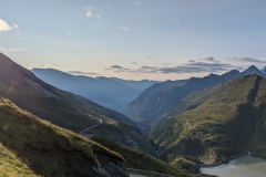
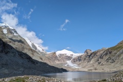
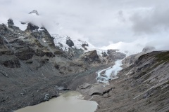
It was 4.5C as we headed for the start of the trail, both wearing two fleeces, a woolly hat and gloves.  The sun was out and the weather looked much better than yesterday.  The first part of the trail led down to the lake, with lots of hairpins and partial steps.  We made it slowly to the bottom and took a photo from the point where the glacier had been in 1980.  There was no glacier at all 16000 years ago, and it has been growing and shrinking ever since.

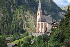
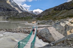
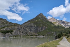
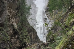
We continued round the lakes, then enjoyed a walk through woods, but with some big descents as we dropped from one valley to another.  We stopped for a short rest and removed our fleeces and swapped our woolly hats for sunhats.  There was a huge waterfall where we stopped for photos and I noticed that the flow over the top had suddenly increased.  We retreated higher up the path and watched as the water rose under the bridge that we had just crossed.  A further few kms through pasture land and we stopped at a small café in the middle of nowhere.  We had a good coffee with cream, and apple strudel with cream.  Revived, we carried on to where we joined a small road and followed it to our hotel in Heiligenblut.


Total distance: 16281 m
Max elevation: 2374 m
Total climbing: 345 m


AA Day -01

Our driver picked us up to take us to Gatwick.  This was (hopefully) the most dangerous part of the trip, as he regularly took both hands off the steering wheel, would drive up behind another vehicle and then slam the brakes on…  It was just like being back in the Middle East.  As we drove, the BBC announced a complete failure in UK air traffic control, and there were no planes in the sky as we approached Gatwick.  We checked into the hotel and then walked to the terminal to investigate the bag wrapping.  It was a bit like the fall of Saigon, with queues everywhere, and not a single BA desk manned.  We found the bag wrapping service, and decided to get them wrapped the next morning as they opened at 4am.

Dinner in the hotel, then up early and over to the terminal.  Sleeping bodies everywhere, but our check-in was easy using the bag drop.  We arrived in the lounge, then were told that our 7:20 flight was delayed until 10:15.  There was panic in the lounge when the board went from no information to showing that the gate had closed.  We finally boarded and took off at 10:00.  Landing at Salzburg was weird as we were the only plane in the entire airport.  Our bags arrived and we removed the tens of metres of plastic wrapping.  The customs officers had disappeared by the time we went through the green channel.

There was a very unfriendly ticket machine and we got our tickets about a minute before the tram arrived; several passengers didn’t bother with tickets.

We reached the main railway station to find more chaos; the train route we wanted to take was closed due to massive rainfall and there was a bus operating instead.  We bought rail tickets and went outside where one of the organisers pointed us in the direction of a replacement bus.  This left a couple of minutes after we boarded and we had about an hour’s drive down the motorway to another town.  We filled in our waiting time with a coffee and cake, before heading back for the train.  There were another four people on the platform and they suddenly all started off down the stairs.  Someone had spotted that our train was now due to depart from a different platform.  We made it, and had about an hour’s journey to Bruck, mostly alongside the incredibly swollen river.  At Bruck it was a short walk to our hotel.

Two days of chaos; we hope that things improve!

AA Day 00

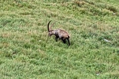
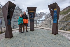
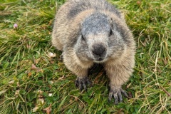
Woke to an overcast day with low cloud but no rain.  We had a good breakfast with a big choice of freshly made bread.  We walked 1km to the bus stop and found another family there when we arrived.  The bus came early, complete with a national park tour guide who provided commentary in both English and German.  The guide told us there was another person also travelling on the bus who is starting the walk tomorrow.  (We chatted to Susan later.)  We were shocked to see that the toll for the road was 40 euros for a car!  The road climbed up and we had a stop for coffee and an exhibition of various minerals found in the area.  Further up and there was fresh snow lying, which was a bit worrying for our walk tomorrow.  This route had been used by the Romans, and throughout Medieval times for trade between Italy and the Salzburg region.  We drove through a number of tunnels, with the last one taking us onto the south side of the mountains.  The weather immediately improved with glimpses of sunshine and no more snow.  The road dropped down before climbing back up to the Kaiser-Franz-Josefs-Hohe where the road ended.  There was a view of the glacier in the distance and we were lucky to see the top of Grossglockner, the highest mountain in Austria.  The guide said that it was usually covered in cloud, despite the cloud everywhere else.  It was easy to spot marmots and ibex in the valley below.  We visited the start of the Alpe-Adria trail, had a look round the exhibitions of Porsche cars, the history of women mountaineering, and flora in the mountains.  We then went off to explore our accommodation for the night, passing some very tame marmots on the way.  We had left our rucksacks in the bus while we explored and were able to take a lift down to the bus and back up directly from the hotel.  We checked in to a nice room.  Online reviews of the food don’t look too good; we will shortly find out for ourselves.  (The other restaurant gets even worse reviews)

Newer posts »

© 2024 Travelling Slowly

Theme by Anders NorénUp ↑