Walking and Sailing

Category: Jura (Page 2 of 3)

Jura Day 13

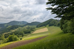
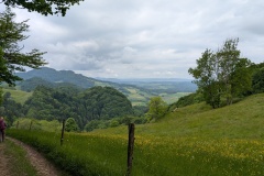
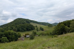
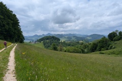
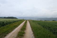
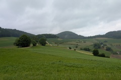
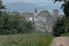
Today’s stage would end at another of the mountain crossings.  There is no accommodation at the stage end, so we could either walk down to our hotel in Olten, or get the bus.  The bus was either at 14:08 or 16:08, and as we had a late start our initial plan was to walk down.  The first part of the walk was on a very good path, over a hill and down to the first of the north-south crossing points.  On the way down we looked for the border stone, marking the Swiss-Austria border in the late 18th century.  We didn’t see it, but it’s amazing to think how far west the Austrian Empire extended.  We were soon climbing the next hill on a narrow path, which got narrower along the ridge.  It wasn’t nearly as bad as the ridge walk on the first day, and we were soon back on wide paths.  At this stage, we thought we would be about 30 minutes late for the bus, but as the path was good, we kept walking and decided to try for the bus.  The path went up over a hill but we took the alternative route round the side.  Many of the route signposts show the time to the end of the stage, and we saw that we were gradually gaining time.  There was lovely scenery throughout the day, with views northwards to the Black Forest.  It was overcast most of the day, and cool, so that helped with our walking speed.   There was loads of bird life with red kites and buzzards circling for most of the day.  Our next time calculation suggested that we might miss the bus by about 5 minutes.  We had passed the possible trail walk down to Olten so kept going; now there were a lot of farm gates that I would jog on to open, then close and catch up with Christine.  Near the end, we cut off the trail and walked down the road, reaching the bus stop with about 30 minutes to spare!

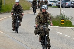
While we sat at the bus stop a group of Swiss soldiers came down the road on bicycles and turned right just before the bus stop.  The next lot of about twenty came zooming down and it was obvious they were going to keep going straight on.  I wanted to stop them, but Christine thought they must know where they were going.  Seconds later, more arrived, and I stopped them as they seemed to realise they should be turning right.  One went after the others, and a few minutes later they all reappeared, cycling on the wrong side of the road, and now going in the correct direction.  We got a thanks from one of the officers.

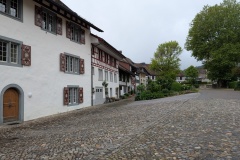
The bus arrived and took us down to town.  It was a drop of about 400m, so we were glad we hadn’t walked down.  Olten doesn’t seem to have a historical centre; it really grew at the start of the Swiss railways and is now a major hub linking Zurich, Basel, Berne, and Lucerne, all within 30 minutes of here.

Having not seen anyone walking for days, today we saw a total of 14 people.


Total distance: 18974 m
Max elevation: 886 m
Total climbing: 713 m
Jura Day 12

Last night’s hotel was a typical 1970s station hotel, complete with a smoking bar.  We made the mistake of exiting the hotel through the bar and it brought back memories of upstairs on the bus…  We had a good evening meal in a French brasserie, just across the road.

No breakfast at the hotel, so we stopped at a cafe for a pastry and coffee, both very good.  It was overcast and damp when we left, and we had our jackets on and bags covered.  It drizzled most of the day, and when it wasn’t raining in the forest we got wet with the water coming off the trees.  At least most of the paths were wide so our legs didn’t get soaked.

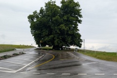
The route out of Brugg followed an old track, before leading us through some housing.  We then got into the countryside on a wide track.  The whole day alternated between wide tracks (some paved) through fields or forests, with only a few narrow sections.  We stopped for a rest at a bus stop in Linn (cover and seats) and admired the 800 year old lime tree (supposedly it was planted over some plague victims and after that the plague never came back to the village).  It got quite chilly and we put our fleeces on before carrying on with the walk.  Even going uphill it was decidedly cool.  We had one exposed section with the rain blowing across us, but it wasn’t too bad, just miserable.  The path finally dropped down to the end of the stage at Staffelegg.  The cafe/hotel was shut for its weekly day off, so we sat in the bus shelter and had some chocolate while watching the hundreds of cars and trucks crossing over the col in each direction.  It’s one of the lowest Jura passes, but apparently a very important transportation axis; possibly it’s used by those who don’t want to pay for the nearby motorway tunnel.  We then had a short walk to this evening’s accommodation.  It’s a conference/education centre and a wind ensemble has been practising since we got here; you can hear them in the corridor but not in the bedroom.  (I’m debating whether to sign up for the September Alphorn instruction week).

It’s still overcast, but the forecast for tomorrow looks much better.


Total distance: 19341 m
Max elevation: 758 m
Total climbing: 753 m

Jura Day 11

Our eleventh day, but the first day on the Jura Crest trail.  The Swiss tourist board promised “wonderful views from the ridge, south to the Alps”.  The key thing missing from the promise was “if the sun shines”.

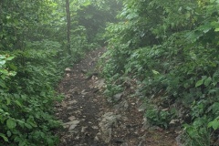
Looking out of the window in the morning, the cloud was almost down to the village.  We left the hotel and started climbing immediately.  The path was very good, and the temperature was cooler than yesterday, but the humidity was close to 100%.  We passed through the village of Regensberg, an old walled town with a spectacular view back down to the valley.  The path continued as a nice, wide, trail and we were congratulating Switzerland on the state of its trails, when it suddenly narrowed along a ridge.  The limestone was dipping at about 70 degrees, and we had to walk along between the beds.  After last night’s rain all bare rock was extremely slippery, and you had to be careful wherever you put your foot, or planted a pole or put any weight on it.  This section was probably about 2km long, but seemed to go on forever.  I was going first, and got soaked with the water on the bushes after last night’s rain.   I even managed to get my boot stuck between two rocks, and had to take my foot out of my boot before I could pull it out.  We finally got back onto a reasonable path through the woods, before it widened to a forest track.  The path then dropped down to Baden.  The rain started just as we entered the town, Christine put her rain jacket on, I ran to the coffee shop.  We had a cake and coffee each and by the time we left the rain had stopped.  We climbed a lot of steps to get out of the town, past a church.  Then we were back into the woods, but on a very good path.  The rain started coming down, so we put our jackets on and covered our bags.  This, of course, guarantees that the sun will shine within the next ten minutes and you have to stop and take your jacket back off.  Approaching Brugg, we cut off the trail and onto a road leading down to the town.  There was lots of thunder and it looked very dark to the west.  We made good progress, and were nearing our accommodation when the heavens opened.  We nipped into the entrance to a car park for some shelter, and put our jackets back on.  After about ten minutes the rain abated and we walked the final 400m to the hotel.


Total distance: 23880 m
Max elevation: 870 m
Total climbing: 901 m

Jura Day 10

A decent breakfast, then we walked to the bus station (via the Coop to buy some water and dried fruit).  The bus took us to the outskirts, about 5km along a dead straight road, which we had decided would not be a very pleasant walk.  It was a short walk from the bus stop to the start of the trail, though there was a slight detour due to major bridge and road works.  We walked alongside the river on an almost flat path.  There were a couple of sections where the path stretched into the distance, dead straight for a couple of kilometres or more.  The fields on our right were mainly full of vegetables.  We finally climbed up a long set of steps to leave the river valley, walked alongside the railway on a narrow path, reached a huge industrial area and railway station, and then dropped down 200m to an old sawmill in a quiet hollow.  It was hard to believe that what we had walked through existed only a short distance away.  

We then had a long climb up through the forest, finally reaching the top and seeing Dielsdorf (the start of the Jura Crest walk) across the valley.  We dropped down to Bulach and followed a road through the centre of town.  We were soon back out in the country, in very flat land.  We were also on the landing path for Zurich airport, and had a plane going overhead every minute.  We finally crossed the plain, again with many long straight sections alongside ditches or streams, before finally climbing up to Dielsdorf.  As we entered the village, a stork was mobbing a red kite; it was a bit like a jumbo jet trying to take out a jet fighter, with the kite easily evading the stork.  A local builder had put up a pole in the village, as he remembered the storks from his childhood, and it seems to be successful as there was obviously a pair on the nest.  He has also put up twenty nesting poles in his building yard, some of which are successfully being used.

As we ate our evening meal the rain started and looks as if we will get wet over the next couple of days.


Total distance: 22693 m
Max elevation: 563 m
Total climbing: 419 m

Jura Day 09

The E4 heads SW for a couple of days from Stammheim.  While planning, I couldn’t find any accommodation in the 20-30km walking range, and there were no easy bus or train connections to accommodation.  I therefore planned a day’s walk south to Winterthur, and then a second day walking west to get us back onto the E4.  There are thousands of marked paths in Switzerland, so it was easy to plan.  

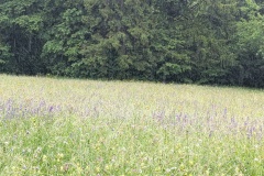
We had a good breakfast and started our walk.  After about an hour of walking, I suddenly realised we were on the E4 rather than our alternative route.  (Why?  The previous night walking to the restaurant we had followed signs for the E4, and I guess this had somehow stuck in my brain…)  Luckily there was a road that would take us to the correct path, but we passed 2km south of our start point after walking for 1.5 hours.  Once we were on the correct path, it was a generally easy walk.  As we walked south we crossed three low lying ridges.  These all extend a long way east-west, and I wonder if they are glacial moraines.  There was a broad, flat, valley in between each.  (The photos show the views from one ridge to the next)  Today was probably the hottest so far, and there were no cafes in any of the small villages that we walked through.  We did have plenty of water with us.  The countryside was a mixture of vineyards, forests, and fields of barley, corn, and vegetables.  All day there were red kites overhead, often swooping low down over the fields, at other times fighting (or courting?).  We walked on a mixture of deserted country roads and tracks, though did cross over a motorway.  The final section was through a forest that took us into the suburbs of Winterthur, and it was then only a couple of kilometres to the hotel.  It’s a lovely temperature and we had dinner on the hotel terrace.  

Another day of walking and we reach the start of the Jura Crest trail!

Total distance: 25934 m
Max elevation: 526 m
Total climbing: 519 m

Jura Day 08

We visited a bakery for croissant and coffee and were soon on our way, walking westwards along the Rhine.  Being Switzerland, the numerous paths are well signed, and they generally try to keep cyclists and walkers apart.  At times (from South to North) there was the main road, a field, the cycle path, the railway, the walking path, some greenery, the Rhine. There were a few groups of rowers on the Rhine, the occasional train, and lots of red kites.  There were also lots of cyclists, so it was good not having to share a path.  It was a pleasant walk and we kept up a good speed.  We walked through vast orchards of pear and cherry trees.  (A quick calculation put the pear trees in the hundreds of thousands). 

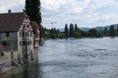
We reached Stein am Rhein and crossed over the bridge to visit the old town.  This is the first narrowing of the Rhine after Lake Constance and you could see that it was a river rather than stationary water in a lake.  The town was crowded with tourists, come to admire the painted scenes on the walls of the houses.  (All the manhole covers had St George and the dragon on them because of the monastery’s connection with St George!).  We had a nice lunch, did a quick circuit of the town centre and then headed back to the south side of the river.  We finally had to do some climbing as we headed south, up through the forest, but it wasn’t for long before the short descent down to Oberstammheim and the hotel for the night.  The restaurant was shut so we walked along to an Italian restaurant (second in two nights).  The streets were deserted as we walked there, and we were able to get a table easily.  By the time we left, the restaurant was full, inside and on the two terraces outside.  Where had all these people come from on a Sunday night?  We walked back to the hotel, again along deserted streets.  The hotel is in a historic building; we are in one of the converted farm buildings with all mod cons.


Total distance: 18804 m
Max elevation: 589 m
Total climbing: 400 m

Jura Day 07

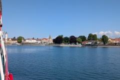
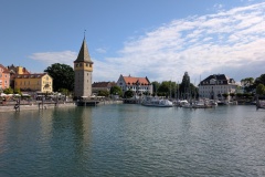
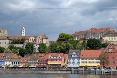
We had a very good, leisurely breakfast, and then walked the five minutes to the jetty.  About fifty people got on the boat, and we were able to bag a table on the back deck, in the sunshine and mostly out of the wind.  A couple of the other tables got their first round of drinks in as we left the port at 9:40.  The trip lasted four hours, because of the ten stops between Bregenz and Konstanz.  The voyage took us along the eastern side of the lake before crossing over to Konstanz.  At each port there were more passengers getting on than off, so the ship gradually filled up, though there was plenty of space inside.  Each port/village was very scenic (see the photos).  We soon spotted the first vineyard, and they gradually filled the eastern hillside of the lake.  There were numerous yachts out on the lake, but hardly any wind.  We finally docked in Konstanz and we made our way to a sports shop to get new rubber tips for our walking poles; we had both lost one in the mud a few days ago and the noise of the metal spike on a hard road surface is fairly annoying.  The centre of Konstanz was very busy; apparently many Swiss drive in to do their shopping.  We walked out of the centre and were quickly into quiet residential streets and then walked through a large, unmanned customs point and into Switzerland.  It was now about 2:15pm and we had sixteen kilometres to walk to our accommodation.  The path was a mixture of either combined cyclists and pedestrians, or pedestrian only paths and we made good progress.  The Rhine is very wide here, almost a lake, and it was not possible to see any flow on it.  There was lots of bird life; swans, coots, and various ducks.  We had a couple of rest stops and reached our accommodation at about 5:30pm, having averaged exactly 5kph for 3.5 hours of walking.  The accommodation (studio) has a washing machine and tumble dryer, so we were able to do a wash before heading out for a pizza.  Three countries in one day, and we are now in Switzerland to the end of the trip.


Total distance: 17189 m
Max elevation: 412 m
Total climbing: 131 m

Jura Day 06

It was a relaxing day, with the bus ride to Bregenz.  We got up late and had a nice breakfast of cereals, local cheese and ham with eggs, and bread with numerous fruit spreads, all served with fresh juice and coffee.  We walked down the hill to the bus stop, and with time to kill, had a coffee in the local shop.  

Over the last few days we’ve seen more tractors (from old to new) than I’ve ever seen before.  The first cut of silage has already taken place, and the current work is either turning it to dry, taking it for storage, or spreading muck for the next crop.  There’s plenty of cows in the bits that haven’t been cut, though most herds only seen to number about a dozen cows.  We did spot a few cows that have been moved up the hillsides.  This area is also the place to come if you want to buy a new tractor or piece of farm equipment as we’ve passed several huge suppliers. 

We crossed the road and the bus arrived on time.  The valleys and hills run east to west, and the route basically went east descending the south side of a valley, across the valley floor, then west ascending the next ridge, repeating this three times before dropping into Bregenz.

We bought our tickets for tomorrow’s ferry trip and wandered around the town.  The old town is well preserved, lying just above the more modern centre, and the walls are still in evidence.  The old town measures about 100m by 200m.  Bregenz’s claim to fame is probably the opera scene on the lake in the James Bond film Quantum of Solace.  While walking we spotted a zeppelin flying overhead; Mr Zeppelin was born in Konstanz and there is a museum in one of the lake side towns.  

The walk along the lakeside to Konstanz is about 60kms and was described by a previous blogger as boring, walking through numerous lakeside camp sites, and taking care not to step on sunbathers in various states of undress.  We therefore decided to take the ferry. The lake is huge, over 40kms in length so our trip tomorrow takes about 5 hours including stops.  We will then have an afternoon walk to our next stopping point.

It’s been chilly the last few days, cold enough to wear a fleece even when walking, with the wind blowing from the north.  Flicking through the Austrian TV channels last night, I saw the meteorologist explain that it is due to the “omega effect”.  There’s a big high sitting over the UK and a low immediately to the east of it, with neither of them moving.  The wind therefore comes from the Atlantic, up and round the high clockwise, down between it and the low, which it then goes round anticlockwise, giving an omega shape.  These northerly winds are bringing us the cold winds.  He didn’t say how much longer it would last.

Tomorrow we leave Austria, have a short walk through Konstanz (Germany) and then into Switzerland.

Jura Day 05

Breakfast was cereal, bread with butter and marmalade or jam, and a hot drink.  We walked back up to the ridge and admired the view south.  We could just make out some peaks much higher than everything else in the far west.  (maybe the Eiger?  You might see them by opening the photo and zooming in).  We dropped off the ridge on a track made of interlocking concrete blocks so although steep, the surface was good.  We reached the valley and followed a farm track.  As we crossed from Germany into Austria there were various signs, the first we have seen on our numerous crossings of the border.  Further down on the Austrian side there was a shack and a large sign quoting the duty for various types of vehicles to cross.  As the track on the German side didn’t go anywhere we couldn’t work out why anyone would drive there.  The track became a road dropping slowly down the valley.  By now Christine was starting to have the same symptoms as I had two days ago, so we dropped our pace and made good use of the regular benches.  We branched off the route to pass through a village and stopped for a cake and drink.  It was then only another 30 minutes of walking downhill to the hotel.  Dinner was good, but the portions were enormous and we each left half of our main course.  It was another early night, and we’ve decided to take the bus to Bregenz tomorrow rather than suffer for another day.  From Bregenz we have several days on the flat before reaching the Jura.


Total distance: 15142 m
Max elevation: 1656 m
Total climbing: 222 m

Jura Day 04

The plan for today, following the E4, would take us up onto the ridge and along it, finally finishing at the Staufner hut.  After yesterday, we decided to take an easier route, along the valley and then climbing the final 400m to the hut.  It would still be over 1000m of ascent, but would save us the additional 400m of ups and downs along the ridge.

We left the hotel and were soon on the valley road, walking through a number of ski areas.  There wasn’t much evidence of them apart from the regular, huge car park signs showing the number of free spaces.  We counted over 3000 spaces in the valley!  It was a pleasant walk along the valley, gradually climbing as the road went through meadows and woodland.  We passed a barrier and after that there was only us and the occasional cyclist.  Everyone has e-bikes; we’ve seen maybe two in a hundred actual “propel them yourself” bicycles.  We eventually reached the road end and started our climb to the hut.  The first section was on a good track with a solid surface which wound its way up the hillside.  We then went onto a much narrower path with some fairly steep sections.  There was a final climb (see photo), and then we were on the summit and heading down to the top of the ski lift.  From there it was another 10 minutes to the Staufner hut.  We had booked a “double room” so we had a room with a bunk bed in it to ourselves.  Dinner was pasta with pesto sauce, and some sort of sponge cake; OK but nothing special.  The hut looked out to the north over the German plains; a great view.  We retired to bed early.  I was in the top bunk which was probably the greatest challenge of the day; the ladder extended above the height of the bed and you had to negotiate the space without hitting your head or back on the ceiling.  I managed the contortion without cramping any muscles.  (getting down the next morning was equally tricky)


Total distance: 18054 m
Max elevation: 1734 m
Total climbing: 1082 m
« Older posts Newer posts »

© 2025 Travelling Slowly

Theme by Anders NorénUp ↑