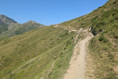
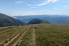
We left the refuge and started along the east side of the lake to rejoin the GR10. Looking at the map, we realised we could walk up one of the ski roads and cut a large corner, so that’s what we did. We had a fairly short climb and then a walk along a path that took us through the ski area before rising up to join the GR10 at the col. This probably saved us about an hour of walking. Rather than taking the GR10 along the hillside, we walked down the road, allowing us to walk without having to watch where we put our feet. A couple of kms further on we joined up with the GR10. This took us along the hillside before starting to descend across moorland. We could see the gondola operating from the village far below us to the ski centre on the other side of the valley. We finally reached the treeline, and then one of those apparently never-ending descents started as we zig-zagged down through the trees. At any road crossing we now compare the length of road that could be walked (usually along to a hairpin bend and back) versus the GR10 route through the trees on a steeply descending track. We can easily walk at double the speed on the road versus the track, so the maths is simple. At the second road crossing we turned onto it and followed it (no hairpins) down to our hotel. The hotel is on the outskirts of Saint-Lary-Soulan, and we walked into the village to visit the launderette. The village was mobbed and looks very up-market. We ate a strawberry tart each while doing the washing and then visited a tapas bar for our evening meal.
Max elevation: 2218 m
Total climbing: 512 m


